Drainage and soils
The Nile River system is the dominant physical feature, and all streams and rivers of Sudan drain either into or toward the Nile. It enters the country as the White Nile (Baḥr Al-Abyaḍ) in the southeast, about 100 km south of Kūstī, and maintains an extremely low gradient until it is joined by the Blue Nile (Baḥr Al-Azraq) at Khartoum. The Blue Nile, which rises in the Ethiopian Plateau, contributes much of the floodwaters of the White Nile. After the confluence of the White and Blue Niles at Khartoum, the river flows in a great northward-curving course and is known simply as the Nile (Nahr Al-Nīl). Throughout much of the country, however, drainage does not reach the Nile; the rivers of the southwest infrequently reach the Baḥr Al-Ghazāl system, and to the north most hill groups initiate seasonal watercourses that are lost in the surrounding plains.
The surface of the deserts in the north and northeast are either bare rock, a mantle of bare waste, or sandy expanses of mobile dunes known as ergs. In the semiarid zone of north-central Sudan, the layer of rock waste is slightly modified to form immature soils; in the Qawz region, soils are brownish red and of low fertility. Alluvial soils occur at the desert deltas of Al-Qāsh (the Gash) and Barakah rivers, along the White and Blue Niles, and in the alluvial plains of the many small rivers radiating from the Marrah Mountains. The alkaline soils of the south-central plain are heavy cracking clays. The soil of the Gezira (Al-Jazīrah) plain south of Khartoum is deep-cracking uniform clay that has been deposited during the annual inundations of the Blue Nile.
Climate
In northernmost Sudan, northerly winds prevail for most of the year, and rainfall is rare. To the south of this the seasons are characterized by the north-south oscillation of the boundary between moist southerly air and dry northerly air. In winter the north winds of the tropical air mass blow across Sudan. These winds are relatively cool and dry and usually bring no rain. Sometime around May, the moist southerly air of the southern maritime air mass moves northward across the country. Because of this, central and southern Sudan have rainy seasons, the total lengths of which vary according to their latitude.
Sudan is a hot country. The central and eastern areas have the highest mean annual temperatures, typically ranging from the mid-90s to mid-100s F (mid-30s to low 40s C). In the west and northwest of the country, the highest mean temperatures generally range from the mid-80s to mid-90s F (low to mid-30s C). The highest temperatures normally occur just before the rainy season. The mean minimum temperatures in most of the country range from the high 60s to high 70s F (low to mid-20s C); in the west and northwest, mean minimum temperatures are a little lower, ranging from the high 50s to high 60s F (mid-10s to low 20s C).
Precipitation varies from almost nothing in the north and centre to 20–30 inches (500–750 mm) annually in the south. Along the Red Sea the climate is alleviated by sea breezes, and most of the rain falls during winter. In southern Sudan, precipitation usually occurs during the summer months. Dust storms are common in the north and centre, often occurring before rainstorms in the late spring and early summer.
Plant and animal life
Sudan has five main vegetational belts in succession from north to south, more or less in coincidence with rainfall patterns. The desert region in the north is followed southeastward by semidesert, low-rainfall and high-rainfall savanna (grassland) with inland floodplains, and mountain vegetation regions. The desert region, with hardly any rainfall, supports permanent vegetation only near watercourses. The semidesert, with minimal rainfall, supports a mixture of grasses and acacia scrub. Farther south appear low-rainfall savannas that consist of grasses, thorny trees, and baobab trees. Acacia trees dominate these savannas, with one species, Acacia senegal, yielding the gum arabic which was long one of Sudan’s principal exports. The high-rainfall savannas of southern Sudan are more lush, with rich grasses along the Nile that support a large number of cattle. There are intermittent woodlands that dot this belt.
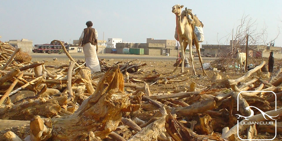
Large areas of Sudan’s natural vegetation have disappeared because of the effects of centuries of cultivation and because of grass fires that annually may sweep across more than half the country. Further dangers to plant life are the effects of overstocking, soil erosion, the lowering of the water table, and the advance of the desert from the north.
The country’s wildlife includes lions, leopards, and cheetahs, as well as elephants, giraffes, rhinoceroses, and numerous varieties of antelope. Several species of monkeys are found in the forests. Resident birds include bustards, guinea fowl, and storks. Reptiles include crocodiles and various lizards. Insect life is abundant, and the tsetse fly is found south of latitude 12° N whenever suitable conditions occur.
Sudan has several protected nature areas, including game reserves and national parks. Dinder National Park, located in the southeast, and Radom National Park, in the southwest, have been designated as UNESCO biosphere reserves.

